Beit Hasan
| Beit Hasan | |
|---|---|
| Other transcription(s) | |
| • Arabic | بيت حسان |
| • Also spelled | Bayt Hasan (unofficial) |
 Beit Hasan Location of Beit Hasan within the Palestinian Territories | |
| Coordinates: 32°14′14.99″N 35°24′13.41″E / 32.2374972°N 35.4037250°ECoordinates: 32°14′14.99″N 35°24′13.41″E / 32.2374972°N 35.4037250°E | |
| Governorate | Nablus |
| Government | |
| • Type | Municipality |
| Population (2006) | |
| • Jurisdiction | 891 |
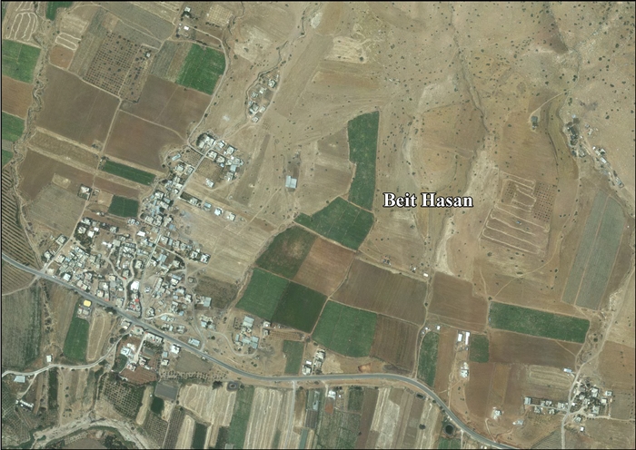
Beit Hasan (Arabic: بيت حسان) is a Palestinian town in the Nablus Governorate in the North central West Bank, located 14 kilometers East of Nablus. According to the Palestinian Central Bureau of Statistics (PCBS), the village had a population of 891 inhabitants in mid-year 2006.[1]
References
External links
- Welcome To Bayt Hasan
- Survey of Western Palestine, Map 12: IAA, Wikimedia commons
- Beit Hasan Village Profile, ARIJ
- Beit Hasan, areal photo, ARIJ
| ||||||||||||||||||||

This article is issued from Wikipedia - version of the Monday, June 29, 2015. The text is available under the Creative Commons Attribution/Share Alike but additional terms may apply for the media files.