Al-Janiya
| al-Janiya | |
|---|---|
| Other transcription(s) | |
| • Arabic | الجانيه |
|
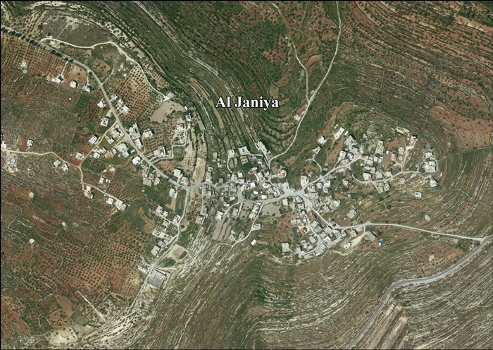
View of al-Janiya | |
 al-Janiya Location of al-Janiya within the Palestinian Territories | |
| Coordinates: 31°56′18″N 35°07′19″E / 31.93833°N 35.12194°ECoordinates: 31°56′18″N 35°07′19″E / 31.93833°N 35.12194°E | |
| Governorate | Ramallah & al-Bireh |
| Government | |
| • Type | Village council |
| Population (2006) | |
| • Jurisdiction | 1,170 |

Al-Janiya (Arabic: الجانيه) is a Palestinian village in the Ramallah and al-Bireh Governorate, located 8 kilometers northwest of Ramallah in the northern West Bank. According to the Palestinian Central Bureau of Statistics (PCBS), the village had a population of 1,400 inhabitants by late 2014.[1]
Farming on local land is now difficult, since Israeli authorities have declared much of it, enclosing olive groves, a 'closed military zone', which Palestinian farmers are allowed to access on average only 2 days a year, and many of the trees are uprooted by settlers.[1]
References
- 1 2 'Denied land access, Palestinians miss olive harvest,' Ma'an News Agency 29 October 2014.
Bibliography
- Barron, J. B., ed. (1923). Palestine: Report and General Abstracts of the Census of 1922 (PDF). Government of Palestine.
- Conder, Claude Reignier; Kitchener, H. H. (1882). The Survey of Western Palestine: Memoirs of the Topography, Orography, Hydrography, and Archaeology 2. London: Committee of the Palestine Exploration Fund. (p. 294)
- Finkelstein, Israel; Lederman, Zvi, eds. (1997). Highlands of many cultures. Tel Aviv: Institute of Archaeology of Tel Aviv University Publications Section. ISBN 965-440-007-3. (II p.314)
- Guérin, Victor (1875). Description Géographique Historique et Archéologique de la Palestine (in French). 2: Samarie, pt. 2. Paris: L'Imprimerie Nationale. (p. 83)
- Hadawi, Sami (1970). Village Statistics of 1945: A Classification of Land and Area ownership in Palestine. Palestine Liberation Organization Research Center.
- Mills, E., ed. (1932). Census of Palestine 1931. Population of Villages, Towns and Administrative Areas (PDF). Jerusalem: Government of Palestine.
- Palmer, E. H. (1881). The Survey of Western Palestine: Arabic and English Name Lists Collected During the Survey by Lieutenants Conder and Kitchener, R. E. Transliterated and Explained by E.H. Palmer. Committee of the Palestine Exploration Fund. (p. 229)
- de Roziére, ed. (1849). Cartulaire de l'église du Saint Sépulchre de Jérusalem: publié d'après les manuscrits du Vatican (in Latin and French). Paris: Imprimerie nationale.
- Röhricht, Reinhold (1893). (RRH) Regesta regni Hierosolymitani (MXCVII-MCCXCI) (in Latin). Berlin: Libraria Academica Wageriana. (de Roziére, 1849, pp. 223-224, No. 120; cited in Röhricht, 1893, RRH, p. 50, No 200; cited in Finkelstein et al., 1997, p. 314)
- Stuart Macalister, R. A. (1905). "The modern inhabitants of Palestine". Quarterly statement - Palestine Exploration Fund 37: 343–356. (p. 354)
External links
- Welcome To al-Janiya
- SWP map 14, IAA
- SWP map 14, Wikimedia commons
- Al Janiya Village (Fact Sheet), Applied Research Institute - Jerusalem (ARIJ)
- Al Janiya Village Profile, Applied Research Institute - Jerusalem (ARIJ)
- Al Janiya , areal photo, Applied Research Institute - Jerusalem (ARIJ)
- Locality Development Priorities and Needs in Al Janiya Village, Applied Research Institute - Jerusalem (ARIJ)
| ||||||||||||||||||||

This article is issued from Wikipedia - version of the Saturday, December 12, 2015. The text is available under the Creative Commons Attribution/Share Alike but additional terms may apply for the media files.