Ein Yabrud
| Ein Yabrud | |
|---|---|
| Other transcription(s) | |
| • Arabic | عين يبرود |
| • Also spelled |
'Ein Yabrud (official) Ayn Yabrood (unofficial) |
 | |
 Ein Yabrud Location of Ein Yabrud within the Palestinian Territories | |
| Coordinates: 31°56′51″N 35°14′55″E / 31.94750°N 35.24861°ECoordinates: 31°56′51″N 35°14′55″E / 31.94750°N 35.24861°E | |
| Governorate | Ramallah & al-Bireh |
| Government | |
| • Type | Municipality |
| • Head of Municipality | Awni Hasan Sha'ib |
| Area | |
| • Jurisdiction | 11,488 dunams (11.5 km2 or 4.4 sq mi) |
| Population (2007) | |
| • Jurisdiction | 3,000 |
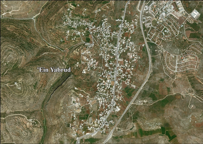
Ein Yabrud (Arabic: عين يبرود) is a Palestinian town in the Ramallah and al-Bireh Governorate in the central West Bank. It is located approximately 7 km northeast of the city of Ramallah and its elevation is 800 m. According to the Palestinian Central Bureau of Statistics (PCBS) the town had a population of 3,000 in 2007.[1] It is the home village of Hamas military commander Maher Udda.[2]
Land confiscation
Jordan confiscated lands of Ein Yabrud and nearby Silwad for the construction of a military camp before the Six Day War.[3] The Jordanian buildings formed the initial basis of the Israeli settlement of Ofra founded in 1975.[3] Plans for further expansion of Ofra in this land in 2011 resulted in legal challenges and public dispute.[3] Land belonging to the residents of the village has be used to construct hundreds of structures in the neighbouring Israeli settlement of Ofra.[4]
References
| Wikimedia Commons has media related to Ein Yabrud. |
- ↑ 2007 PCBS Census. Palestinian Central Bureau of Statistics. p.114.
- ↑ Israel arrests Hamas leader March 15, 2010, Al Jazeera
- 1 2 3 State moves to expand settlement on Palestinian land confiscated by Jordan
- ↑ Akiva Eldar Israel's 'Ulpana neighborhood is built on years of land theft and forgery,' at Haaretz, 24 April, 2012.
Bibliography
- Barron, J. B., ed. (1923). Palestine: Report and General Abstracts of the Census of 1922 (PDF). Government of Palestine.
- Conder, Claude Reignier; Kitchener, H. H. (1882). The Survey of Western Palestine: Memoirs of the Topography, Orography, Hydrography, and Archaeology 2. London: Committee of the Palestine Exploration Fund. (p. 291)
- Dauphin, Claudine (1998). La Palestine byzantine, Peuplement et Populations. BAR International Series 726 (in French). III : Catalogue. Oxford: Archeopress. (p. 832)
- Finkelstein, Israel; Lederman, Zvi, eds. (1997). Highlands of many cultures. Tel Aviv: Institute of Archaeology of Tel Aviv University Publications Section. ISBN 965-440-007-3. (II p.563)
- Guérin, Victor (1869). Description Géographique Historique et Archéologique de la Palestine (in French). 1: Judee, pt. 3. Paris: L'Imprimerie Nationale. (pp. 42 -43)
- Hadawi, Sami (1970). Village Statistics of 1945: A Classification of Land and Area ownership in Palestine. Palestine Liberation Organization Research Center.
- Hütteroth, Wolf-Dieter; Abdulfattah, Kamal (1977). Historical Geography of Palestine, Transjordan and Southern Syria in the Late 16th Century. Erlanger Geographische Arbeiten, Sonderband 5. Erlangen, Germany: Vorstand der Fränkischen Geographischen Gesellschaft. ISBN 3-920405-41-2. (p. 121)
- Mills, E., ed. (1932). Census of Palestine 1931. Population of Villages, Towns and Administrative Areas (PDF). Jerusalem: Government of Palestine.
- Palmer, E. H. (1881). The Survey of Western Palestine: Arabic and English Name Lists Collected During the Survey by Lieutenants Conder and Kitchener, R. E. Transliterated and Explained by E.H. Palmer. Committee of the Palestine Exploration Fund. (p. 224)
- Robinson, Edward; Smith, Eli (1841). Biblical Researches in Palestine, Mount Sinai and Arabia Petraea: A Journal of Travels in the year 1838 2. Boston: Crocker & Brewster. (p. 80)
- le Strange, Guy (1890), Palestine Under the Moslems: A Description of Syria and the Holy Land from A.D. 650 to 1500, Committee of the Palestine Exploration Fund, (p. 550)
External links
- Welcome To 'Ayn Yabrud
- SWP map 14, IAA
- SWP map 14, Wikimedia commons
- 'Ein Yabrud Village (Fact Sheet), Applied Research Institute - Jerusalem (ARIJ)
- ‘Ein Yabrud Village Profile, Applied Research Institute - Jerusalem (ARIJ)
- ‘Ein Yabrud, areal photo, Applied Research Institute - Jerusalem (ARIJ)
| ||||||||||||||||||||
